As a local Butte County resident, I’m lucky enough to live right next door to Lake Oroville. Yet it’s a place I haven’t devoted as much time to exploring as I really should have, so my wife and I set out to correct that during some of our hikes in late March.
The Bidwell Canyon Trail was our first (and my personal favorite) discovery. It winds past some of the nicest parts of our neighborhood and showcases a lot of what we love most about the area. Despite the fact that I’ve lived here for several years, I had missed portions of the Bidwell Canyon Trail, the neighboring Dan Beebe Trail, and a few other local treks. It wasn’t until I used Explore Butte County’s hiking resources that I saw just how much high-quality outdoor adventure was available in my own back yard.
Hit the Trail
Get the interactive map to see the exact routes of the Bidwell Canyon Trail and Dan Beebe Trail
Day One
Bidwell Canyon Trail
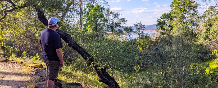
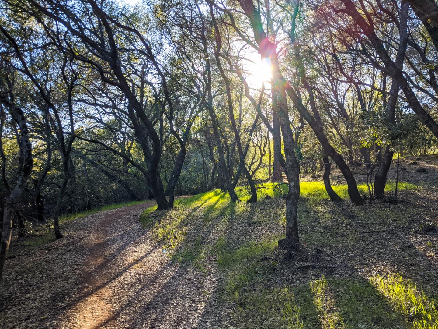
Despite having taken portions of the trail northward in the past, my wife and I didn’t know that the Bidwell Canyon Trail actually runs southward near our home as well. We set out one evening to explore this new side of the trail, thinking it would likely be a short enough hike before we found some sort of end point or a natural place to turn back, but we soon fell into a wonderland of sun-dappled trees, deer sightings, and side paths that we didn’t want to leave.
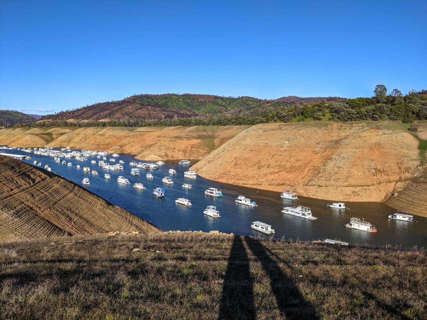
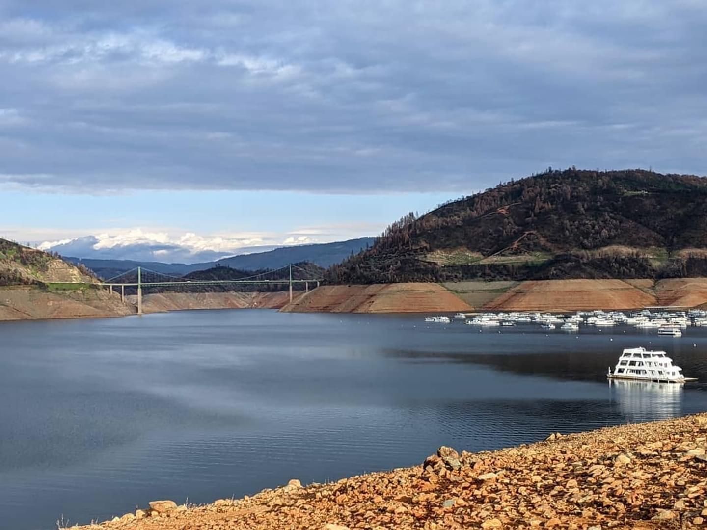
We were running parallel to the Dan Beebe Trail, an equestrian-accessible path that also makes a nice walk for those on foot. It snaked its way along above us in the same direction, and given the popularity of horseback riding from Saddle Dam, we were happy to stick with the Bidwell Canyon Trail for the duration, allowing us to observe folks on horseback from a comfortable distance. Our chosen course kept us closer to the edge of the ridge above the lake, which often made for clearer views of the grassy slopes and the flock of houseboats floating lazily on the lake’s surface.
At one point, we even found a short path that led to a windswept, hill-like slope that would likely be some ways under the lake’s surface during times when the waterline is higher. But it was clear for us to descend with steady footing at the time, peeking out over the houseboats to allow us a clear look at the terminating end of the lake’s lower spike that borders the Loafer Creek Recreation Area. The wind was strong, whipping playfully around us as we watched the sun begin its evening descent, and were it not for our desire to finish the trail and get back before dark, we might have stayed a while longer.
We continued on until we reached the Saddle Dam Day Use Area, where the trail reaches its end, surprised that the other side of the Bidwell Canyon Trail, with all its beautiful sights, had been right under our noses for so long without us having any idea. We headed home at a more leisurely pace, enjoying the return views and evening birdsong. By the time we had finished our hike, we had gone just over 3 and a half miles.
Day Two
Kelly Ridge Point
But we knew we hadn’t seen everything these trails had to offer, and we wanted to round out our experience in order to mark Bidwell Canyon Trail off on our #HikeButteCA passes, which listed the full course as 9 miles out and back. Since we had the luxury of breaking it all up, we decided to take to its opposite side on a separate early evening, following the edge of the lake across wooden bridges, tree-lined hillside, and bursts of wild lilies in bloom. We made our way toward Kelly Ridge Point slowly, taking in the views of the lake’s larger expanse, the houseboats, the distant trees, and the Bidwell Bar Bridge. We had to go up and down some gentle elevation changes, but the northern side of Bidwell Canyon Trail is quite friendly, especially prior to reaching Kelly Ridge Point. The Dan Beebe Trail no longer parallels as closely there (though a spur at its northern crest will take riders and hikers down to Kelly Ridge Point as well), leaving the area wide open to display its natural spaces.
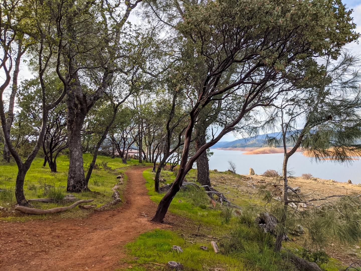
We arrived in time to catch the sunset, watching the shadows lengthen behind us as we walked toward the water’s edge to get a better vantage point for the bridge and the lake waters that extend behind the back of the dam. The point allows for what feels like an almost 360 degree look at the lake’s main body, surrounded by forested hills on the far side of the lake, some scattered rock outcroppings, and orange earth perfect for catching a fiery sunset on camera. We stood entranced for some time, enjoying the contrast of the warm sunlight against the gentle, stone-blue expanse of the water, before taking some landscape photos (and a few selfies) and turning to head back home. The hike turned out to be only a little over 2 and a half miles, though it lasted us well over 2 hours since we spent so much time simply looking out and appreciating everything there was to see.
Day Three
Dan Beebe Trail
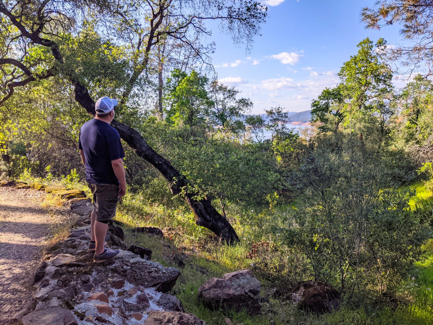
To check-in at the Dan Beebe Trail, we took a third and final outing. We parked just below the Oroville Dam Overlook parking area, which meant we actually started on the tail end of Bidwell Canyon Trail. This part of the trail started with a long (though moderate) incline, and we worked our way slowly up to some nice views of the whole area on a short side path before finding our way into heavier tree coverage as the path continued its climb. It was just under a mile before we hit the Lake Oroville Visitor Center area, where Bidwell Canyon Trail temporarily merges with the Dan Beebe Trail and begins to even out.
We weren’t sure exactly where the trail would intersect with the offshoots we had seen in our previous outing, so we took our time heading downhill again, eventually ending up on the Dan Beebe Trail and then onto the Dan Beebe Spur that goes directly to Kelly Ridge Point. We could have gone back the way we’d come, but opted to turn it into a loop via the Bidwell Canyon Trail instead, which is the outside trail of the two. This made for a walk that took a little longer but was generally less steep. We were tired from the uphill stretch at the start of our journey, so appreciated being able to work our way back without having to go straight back up the spur, which had been a downhill trek of a considerable grade.
Back at the Visitors Center, we took the Dan Beebe side of the return trip so we could see something new, which wound behind some lovely homes nestled into a grassy hillside. The sun poked through at intervals, treating us to charming scenes of domestic life, before we eventually came out near the Dam’s Upper Overlook. It was only a short jaunt from there back to where we’d parked our car, finishing our hike at around 3.6 miles.

We appreciated being able to tackle the Bidwell Canyon Trail in stages, and thanks to its frequent intersections with the Dan Beebe Trail, we felt like we had a great experience no matter where we decided to start and stop our adventure. These trails are local treasures that not even the locals make as much use of as they likely ought to, and we’re glad to know just how accessible they are so we can take them all over again when we have a free afternoon. So if you’re looking for an easy way to see the sights around Lake Oroville—whether leaving enough time for a trip downtown, or fitting in as many miles as you can before your day is done — we hope you’ll make good use of them too.
In Explore Butte County’s “Live Like a Local” series, Butte County locals are invited to share their experiences about the best places to go, see, and experience. “Hike Like a Local” is a specific LLL series focused on hiking trails in Butte County. This is the third piece in the series. Read the first and second piece.
