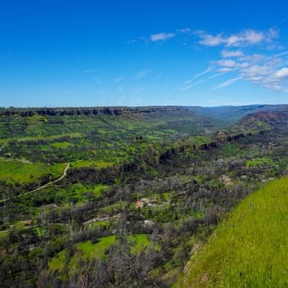
The Butte Creek Watershed is home to high green meadows, pools and riffles, slow moving deep pools, and a “miniature Grand Canyon” as it enters the valley floor. From the Overlook off of the Skyway, you can take in this spectacular vista along the Paradise Ridge.
About the Watershed
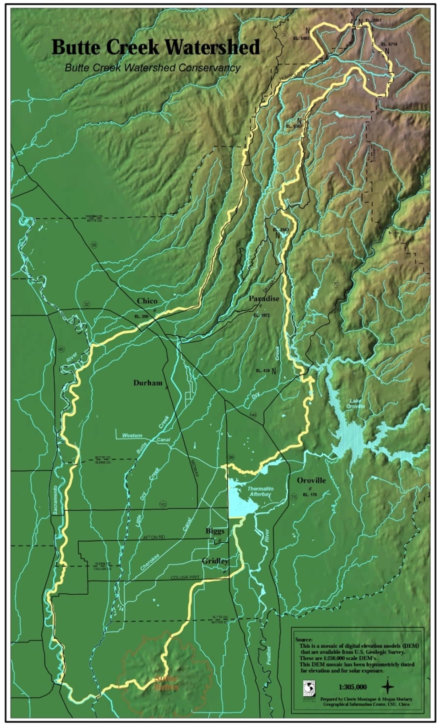
The Butte Creek Watershed encompasses approximately 510,000 acres and lies predominantly in Butte County with smaller portions in Tehama, Glenn, Colusa and Sutter Counties. The watershed is home to a diverse and significant populations of both plant and animal life. This plant and animal life along with the watershed’s various and considerable resources of water, farmland, timber, and recreational opportunities enrich the lives of both its residents and visitors.
Butte Creek, a major tributary to the Sacramento River, originates in the Jonesville Basin, Lassen National Forest, at an elevation of 7,087 feet. Several small tributaries converge in the Butte Meadows Basin, an area characterized by a series of wide meadows and repeating series of pools and riffles. Butte Creek transitions from the Butte Meadows area approximately 25 miles through a canyon to the point where it enters the valley floor near Chico. Numerous small tributaries and springs enter the creek in the canyon area.
The valley section of Butte Creek is divided by the Sutter Buttes, located in the center of the Sacramento Valley. The upper portion is approximately 45 miles in length extending from Highway 99 near Chico to the point where Butte Creek first enters the Sacramento River at the Butte Slough Outfall Gates southeast of Colusa. Historical records suggest that prior to levees being built along the Sacramento River, Butte Creek entered the River in this vicinity. Butte Creek in this reach is surrounded by agricultural lands, several state and federal wildlife areas, and is contained, at times, by a series of levees.
The reach of Butte Creek from Centerville downstream is a productive Salmon fishery, attracting both the endangered Spring-run Chinook and the Fall-run Chinook salmon. Fall-run Chinook migrate upstream for spawning between the months of October and December while Spring-run Chinook migrate between the months of March and June. Juvenile salmon from both races rear in Butte Creek from late winter through late spring en route to the Pacific Ocean.
Butte Creek flows are regulated into the Sacramento River by the Butte Slough Outfall Gates to accommodate both flood flows and agricultural needs in the Sutter Bypass area. The Sutter Bypass section of Butte Creek is approximately 40 miles in length. Butte Creek (now Butte Slough) splits into two channels, known as the East and West Borrow Canals, as it enters the Sutter Bypass near Highway 20. Generally, Butte Creek enters the Sacramento River via Sacramento Slough immediately upstream of the mouth of the Feather River near Verona.

