
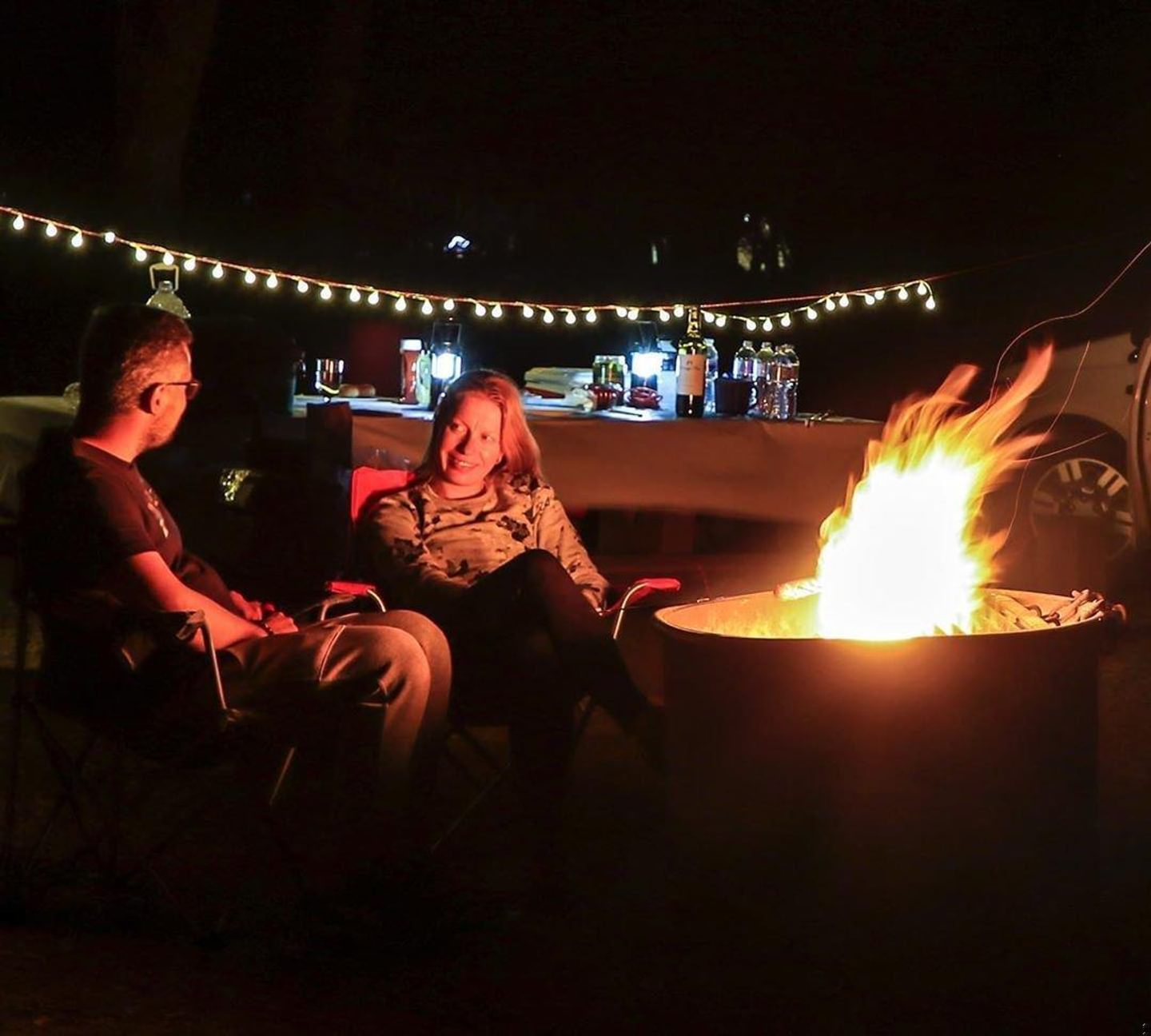
Lake Oroville’s Loafer Creek Area has a lot to offer visitors to California’s second largest reservoir. Bring your tent, trailer, or RV and set up your basecamp at Butte County’s largest campground. Loafer Creek also offers special camping and amenities for equestrians — not to mention miles of trails through oak-studded foothills. The Loafer Creek Area is ready for your whole family with six group campgrounds that can each fit 25 campers. Day-visitors can splash around at the lake’s only designated swimming area or kick back at the picnic area. Loafer Creek is also home to one of Lake Oroville’s boat ramps.
Camping
Loafer Creek’s Coyote Campground has 137 sites nestled in a blue oak woodland. Six sites are ADA accessible and all sites can manage trailers up to 31 feet long or RVs up to 40 feet long. Potable water, restrooms, and coin-operated showers are available to help keep you comfortable. Each site can accommodate eight visitors. Larger groups can reserve one or more of the six group campgrounds, each equipped with parking for eight vehicles, five large tent pads, several tables, and running water.
Loafer Creek Horse Camp has 15 campsites, a washing station, and a warm-up area adjacent to Lake Oroville’s extensive trail system. RVs from all of Loafer Creek’s campgrounds can use the sanitation station found between the campground and the entrance station. Go to Reserve California to reserve your camp between April 1 and October 15. It’s first-come, first-serve during the rest of the year.
Boating and Day Use Area
There are five boat ramps at Lake Oroville that can accommodate trailers and the Loafer Creek Area hosts one of them. Eight lanes are open while the lake remains above 800 feet, while two lanes are available when it’s between 800 and 775 feet. Just past the boat ramp is the Loafer Creek Day Use Area which is a great place to go fishing, swimming, or picnicking. Kids have lots of room to run around on the day use area’s expansive lawn.
Trails
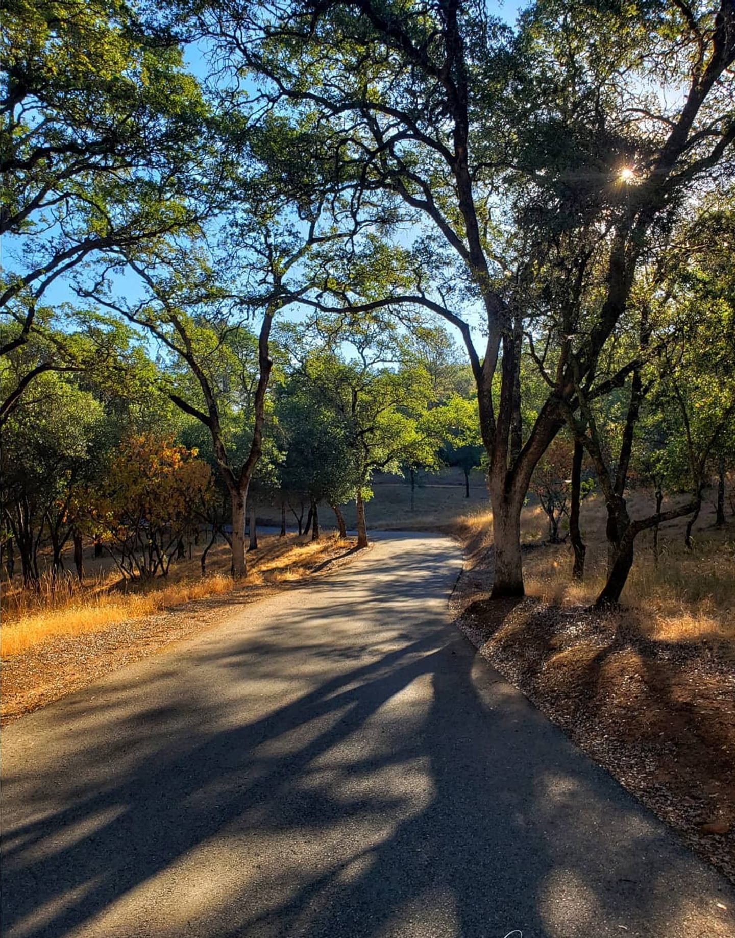
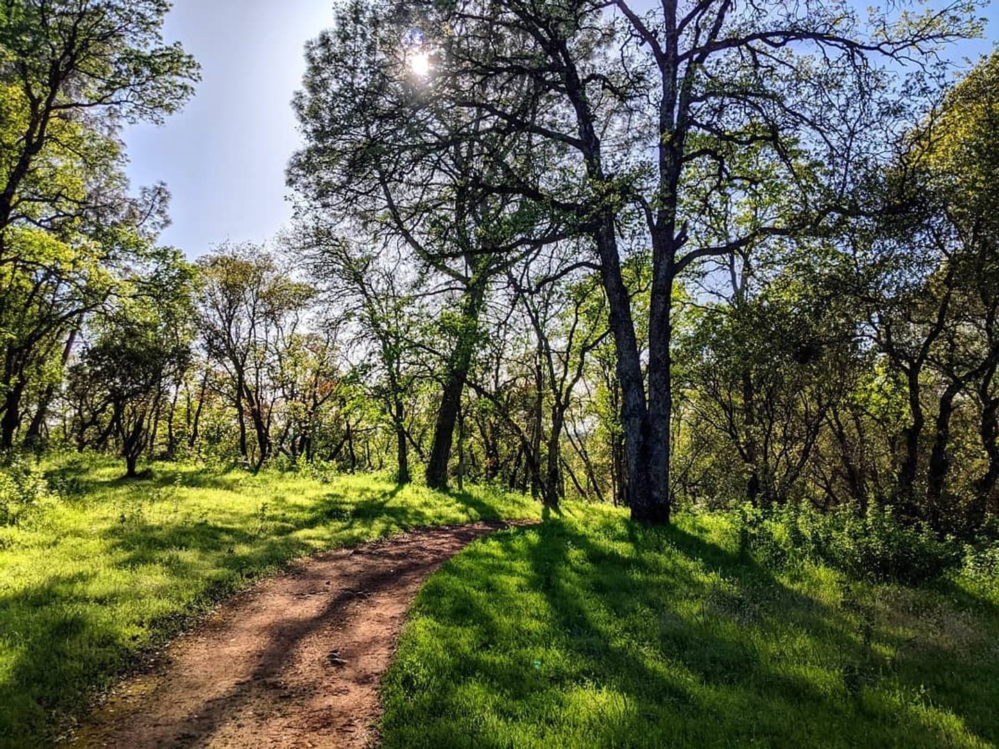
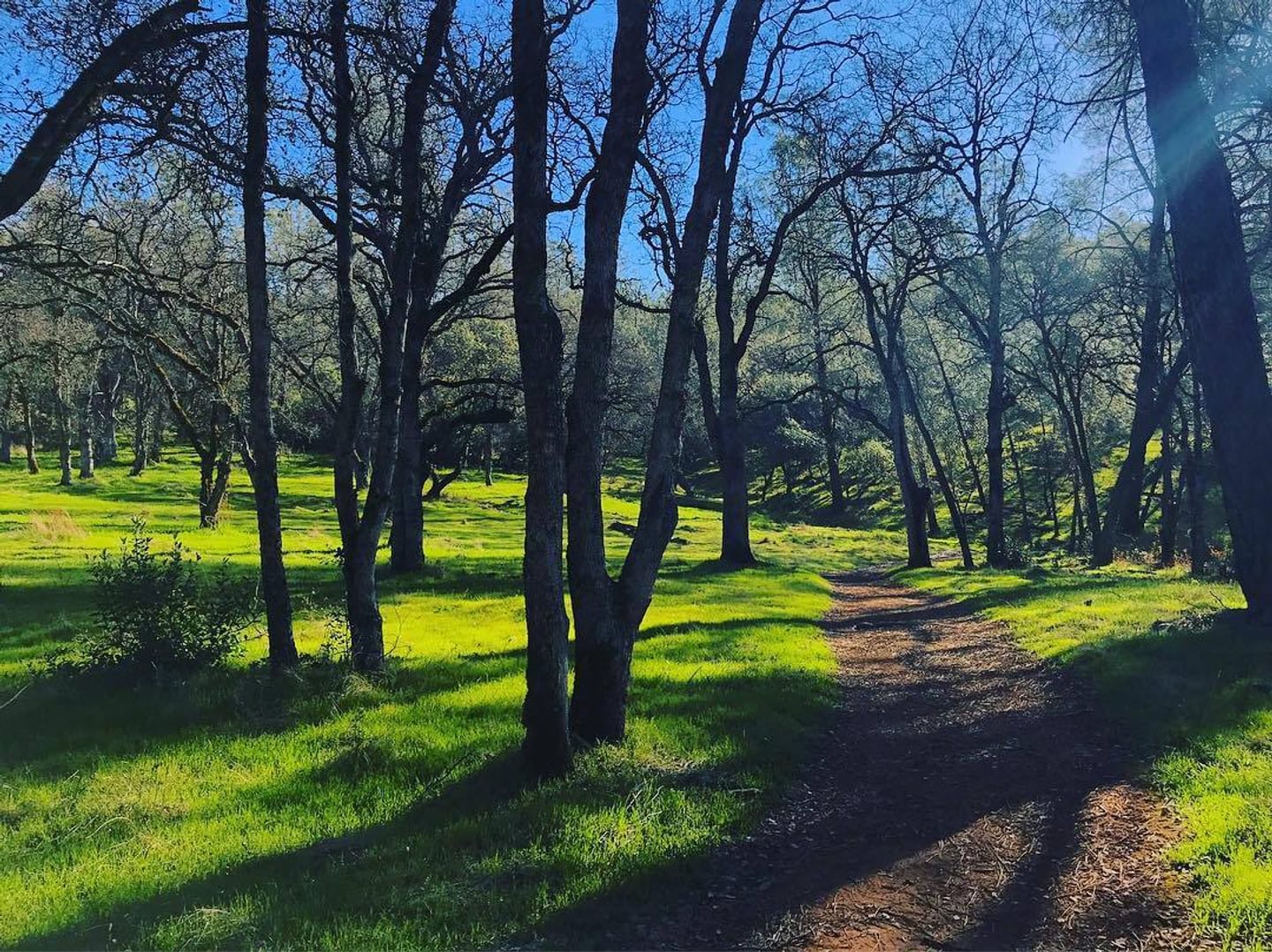
The Loafer Creek Area is set in a beautiful foothill ecosystem that includes blue oaks, digger pines, manzanita, and grassy slopes, perfect for day hiking. Keep an eye out for ground squirrels, woodpeckers, mule deer, hares, and many more creatures!
Loafer Creek Day Use Trail
If you’re looking for a relaxing walk, the Loafer Creek Day Use Trail offers an easy nature walk connecting the Campground, the Day Use Area, and the entrance station.
Key Info
Trail Difficulty: Easy
Trail Length & Type: 1.7‑mile point-to-point
Best Used: Accessible year-round
Dogs: Not allowed
Other Important Info: Wheelchair accessible
Loafer Creek Loop Trail
Accessible from all three campgrounds in the Loafer Creek Campground, the Loafer Creek Loop Trail is perfect for hikers and equestrians. Enjoy rolling hills and a few steeper climbs and descents along the tree-lined trail. You can also access the rest of Lake Oroville’s extensive trail system by crossing Saddle Dam to increase the mileage on this otherwise moderate hike. With the trail overlapping others in the area, you’ll want to make sure to study the interactive map before your trip!
Key Info
Trail Difficulty: Moderate
Trail Length & Type: 3.6 mile loop
Best Used: Accessible year-round
Dogs: Not allowed
Map Links: Interactive Lake Oroville map, CA State Parks Lake Oroville trails map
Other Important Info: Day-use fee required
Roy Rogers-Loafer Creek Loop
By itself, the Roy Rogers Trail in the Loafer Creek Recreation Area at Lake Oroville is a two-mile trail that connects via the northern part of the Loafer Creek Loop, but it is often combined with the aforementioned Loafer Creek trail to create an approximately 5‑mile loop. Along the whole loop, you’ll likely pass equestrians also enjoying the trail while enjoying lake views. The trail is more challenging, with a stretch of frequent ups and downs, but is otherwise pleasant the rest of the way. Start from the day use areas or the campgrounds in the Loafer Creek Recreation Area.
Key Info
Trail Difficulty: Moderate
Trail Length & Type: ~5 mile loop
Best Used: Accessible year-round
Dogs: Not allowed
Map Links: Interactive Lake Oroville map, CA State Parks Lake Oroville trails maps
Other Important Info: Day-use fee required
Driving Directions
You can reach the city of Oroville by traveling south on Highway 99 from Chico. Follow the signs to Highway 149, then to Highway 70. If traveling from the south, take Highway 70 north from Sacramento or Marysville. In Oroville, take Exit 46 and head east on Highway 162 (Oro-Dam Boulevard).
Follow Highway 162 as it turns right onto Olive Highway. It will then turn into Oro-Quincy Highway. When you pass the turn-off for Forbestown Road, Loafer Creek Road will be the next left.
Check out the Lake Oroville State Recreation Area’s brochure for a map of the area and additional information.