
Whether you’re making the return trip from southern California adventures or seeking to explore the wild areas along the California and Nevada border, discover Gold Rush history, unique geology, and scenic byways with a two-day Highway 70 road trip through Butte County (and beyond). This classic road trip will let you experience unique culture in unexpected places, plus great hiking and dining at smaller, out-of-the-way destinations.
From Sacramento, connect to Highway 70 via Highway 99. Or if you want to make a Nevada loop from I‑80, use Highway 65 through Roseville to get to Highway 70. You’ll make a couple of fun stops along the way before getting to Butte County.
Get Ready to Explore
Explore our custom map or get enjoy a guided tour on Google Earth
Due to the remoteness of certain stretches of the highway, closures along Plumas County portions of Highway 70 are common. Please check road conditions before your travels.
Day One
Explore the Bok Kai Temple
Bok Kai Temple in Marysville is a local temple still in use by many members of the Chinese community today, and though not a museum, it offers visitors a chance to worship or respectfully observe the Buddhist, Confuscian, and Daoist iconography on display in a beautiful sacred space located along Marysville’s historic 1st Street. There is also a small Chinese museum at the east end of the street, if you happen to catch it during its rare opening hours and want to do a little more cultural exploration.
Get there: From Sacramento, take I‑5 North to CA-99 North then take the CA-70 North exit. Once you get into Marysville, take a left onto 3rd Street, then a left onto F Street, and follow that around the bend until you hit the corner of 1st and D streets, where you’ll see the path that leads to Bok Kai Temple’s entrance beneath an ornate archway.
Enjoy Bock’s Fruit
Conveniently located right on Highway 70, Bock’s Fruit has been a roadside staple since 1967. From spring through early fall, you can make a quick stop and take home a huge variety of fresh fruit, including their extremely popular peaches, plus a small selection of seasonal vegetables. Once you’ve tried it, you’ll be sure to remember it for your next time passing through.
Get there: From Bok Kai Temple, head back to CA-99 North and follow about 8.5 miles until you see multiple signs on the roadside. You’ll turn left into the Bock’s Fruit lot.
Sip at Mug Shots Coffee House
Your first official Butte County stop will be at Mug Shots Coffee House, one of Oroville’s best-loved coffee hangouts in Downtown Oroville. They have a large offering of delicious pastries and treats, fresh brews and mixed coffee drinks, and fantastic breakfasts and sandwiches. Check out the walls for up-and-coming artists’ work.
Get there: Take exit 47 to Montgomery Street. Take a right on Montgomery and continue just past Myers Street, where you’ll see Mug Shots on the left.

Explore the Oroville Chinese Temple
Oroville has its own beautiful piece of Chinese-American history at the Oroville Chinese Temple. Not far from the bustle of downtown, this hidden gem, which sits close by the Feather River, does occasionally welcome worshipers who come through its doors, but it’s set up as a museum space that showcases a veritable treasure trove of Chinese-American and Butte County history, from tapestries, statuary, and period clothing, to a mock apothecary, arranged temple rooms behind glass, and all manner of photographs and physical items of deep historic value.
Once you’re done exploring the temple, head back across the street and walk or drive east about half a block down. You’ll see a staircase on the left that leads to the walking paths next to the Feather River, which allow for a lovely stroll either to Table Mountain Bridge if you continue east, or to Bedrock Park and eventually Riverbend Park if you head west.
Get there: From Mug Shots, follow Montgomery Street back to Pine Street, hang a right, and continue forward until you see the temple on the left-hand side of the street.

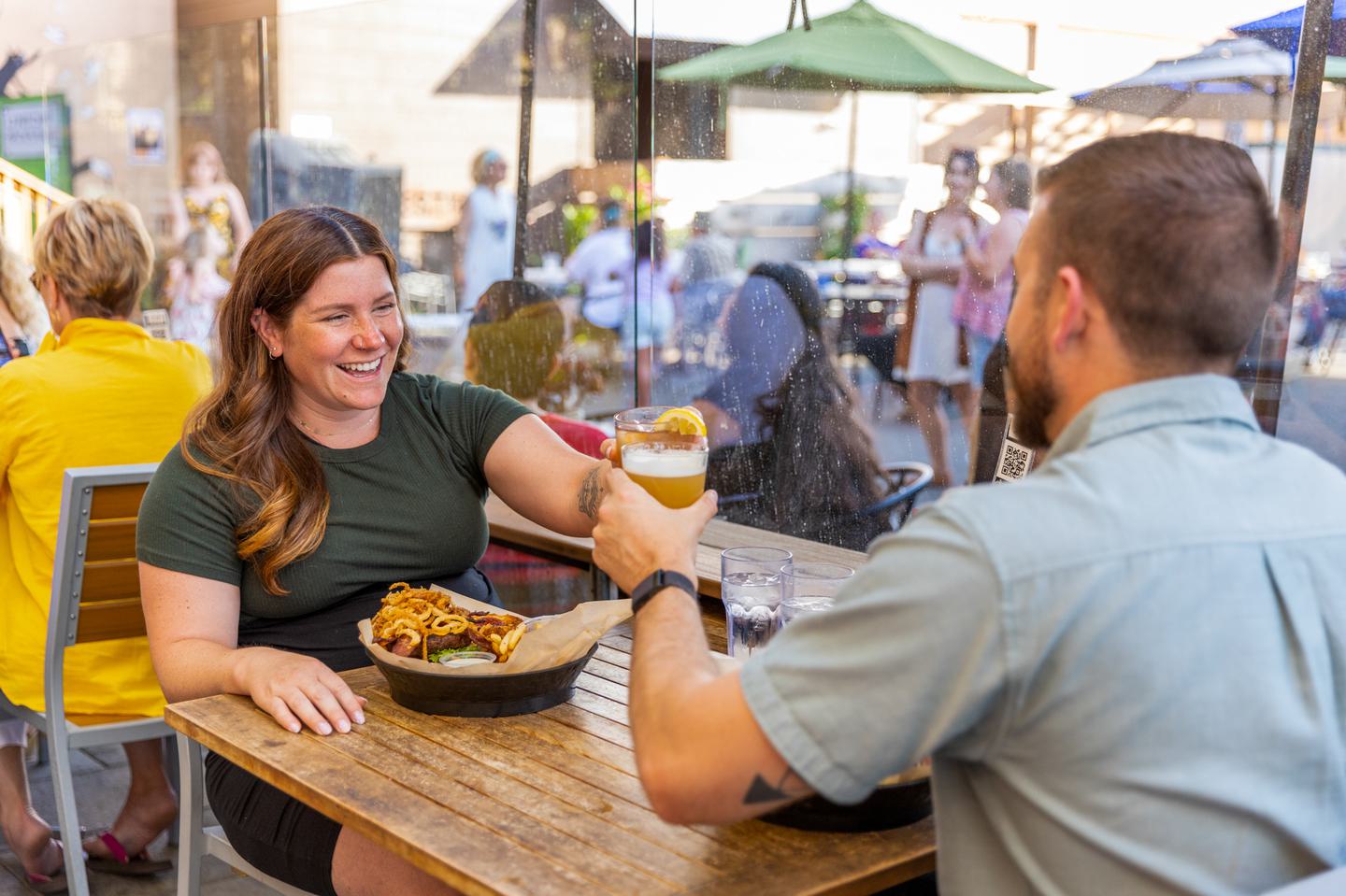
Union Restaurant
Once you’ve had the chance to explore, it will be time for a well-earned feast at Union on Montgomery. One of Downtown Oroville’s hottest eateries, located conveniently right across from Mug Shots, you’ll experience a rich menu with must-try standouts like the Italian crack bread or s’mores tower, a selection of wines, beers, and stellar cocktails to satisfy any group, and some of the best outdoor dining in the area.
Stay the Night
Oroville has lodging options for every budget. Check out Holiday Inn Express & Suites, Hampton Inn & Suites, or America’s Best Value Inn, all of which are centrally located to most anything else you might want to do in town.
Day Two
Dine at Ethan’s Eatery
Grab breakfast at Ethan’s Eatery. Known for its hefty portions, no appetite will come away wanting at Ethan’s Eatery. Try the eggs benedict, fan-favorite mimosa, or the loaded Bloody Mary with its towering skewer of goodies (topped with a muffin!).
Get there: Exit left from the hotel to head east on Oro Dam Boulevard until you reach Myers Street. Take a left to find the restaurant on the right at the corner of Myers and Mitchell.
Explore on Foot
The next stop on your trek should be a walk across Oroville Dam. Parking is available at either end of the dam if you prefer a driving tour, but for some light exercise and the best view, park at the eastern end of the dam and walk across. As the tallest dam in the country (yes, that’s true) you can appreciate impressive views of Lake Oroville and the town below, sit for a while if you want to take it easy, and read a few informational and commemorative plaques. If you drive across the dam to the boat launch area, there are a few grassy spots with tables and seating in addition to public restrooms, and the near (east) side of the dam also has an overlook with even better views in addition to its facilities.
For a more vigorous walk, head to North Table Mountain Ecological Reserve. Created by ancient lava flows, the 3,300 acre ecological reserve is a seasonal mecca for spring wildflower hunters and waterfall chasers. Though most popular in spring, the views of the valley from here are stunning year round.

Take a Break at Rock House Dining & Espresso
Continue your Highway 70 adventure with a stop at Yankee Hill’s Rock House Dining & Espresso. Set on the side of the highway amid the beautiful, rocky, and rugged landscape that begins to stretch out as you head north, the rock house is perfect for scenic selfies in front of the iconic structure.
Get there: Head back to Montgomery and take CA-70 N to CA-70 E if you’re coming from Oroville Dam, or take Cherokee Road to CA-70 E. Rock House will be on your left.

Dig in at Toni’s Mixinitup
Before heading deeper into the canyon, enjoy lunch at Toni’s Mixinitup, the last Butte County destination on the trip (and the last opportunity for food for a while). Dig in to roadside favorites, like their popular Philly cheesesteak, as you take in the picturesque views.
Explore Scenic Byway and Hot Springs
The Feather River Scenic Byway, the state’s first designated Wild and Scenic River, starts about 8 miles north of Oroville on Highway 70 and travels 130 miles west-east across Butte and Plumas counties. From Rock House, continue north on CA-70. The canyon portion of the byway winds through the Feather River Canyon and offers views of cascading waterfalls and wildflowers in the spring and brilliant fall colors in autumn. Outdoor recreation in the forms of hiking, gold panning, kayaking, and fishing can all be experienced along your trek.
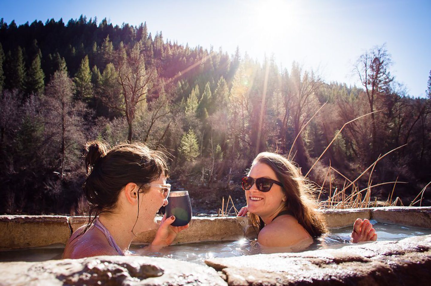
After a leisurely trip and plenty of picture-taking, you’ll come to Feather River Hot Springs in Plumas County, about 42 miles from Rock House. This rather informal hot spring has 3 tubs fed by a natural sulphur spring right next to the river. Reservations are required at least 24 hours before your arrival, so make sure to plan ahead, as this adventuresome spot is a perfect stop for a recharging rest as you make your way through one of the north state’s most beautiful drives.
Explore Quincy
For the last leg of the journey, you’ll take CA-70 East another 14 miles to Quincy, which will become Crescent Street and intersect with Main Street in the center of town. Grab a bite and consider retiring to a local lodging property for the night before continuing on your way.
Continue the Adventure
Once you’re back on the road, you can take CA-70 East into Nevada, eventually meeting up with US-395 South which will take you to Reno. Where your adventures take you from there is up to you, but we hope that your time in Butte County will be a memorable part of your story when you get back home.